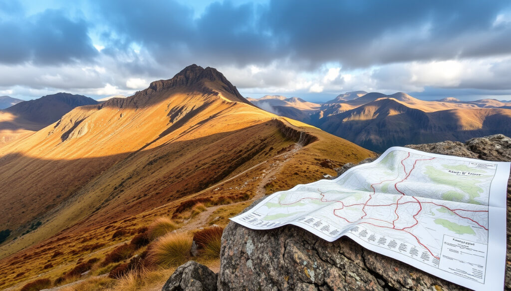
Cadair Idris – Height, Routes, Maps and Essential Walking Guide
Cadair Idris, also spelled Cader Idris, is one of the most celebrated mountain walks in southern Snowdonia. Its rocky summit, Penygadair, rises to 893 metres (2,930 feet) above Dolgellau and the Mawddach estuary. The mountain offers a challenging but rewarding day out for walkers, with several distinct routes, dramatic glacial lakes, and a rich tapestry of legend and natural history.
The mountain is part of the Cadair Idris National Nature Reserve, managed by Natural Resources Wales, and lies on the southern edge of Eryri (Snowdonia) National Park. Its prominence in the landscape and cultural significance make it a destination for thousands of visitors each year. Whether you are planning a first ascent or returning for another route, understanding the key facts, routes, and conditions is essential for a safe and enjoyable experience.
This guide brings together verified information from official sources including Visit Wales, Eryri National Park Authority, Natural Resources Wales, and Ordnance Survey. It addresses the most common questions walkers ask, from height and difficulty to weather, route choices, and local legends.
How High Is Cadair Idris and What Makes It Special?
| Height 893 m (2,930 ft) One of the highest peaks in southern Snowdonia |
Popular Routes Pony Path & Minffordd Path Two main ascents from opposite sides |
| Average Time 4–6 hours Depending on route and pace |
Location Near Dolgellau, Gwynedd, Wales Southern edge of Snowdonia National Park |
- Cadair Idris offers two main classic routes: the gentle Pony Path from the north and the steeper Minffordd Path from the south-east.
- The summit, Penygadair, provides panoramic views of Cardigan Bay and the Snowdonia range.
- The mountain’s name translates to ‘Chair of Idris’, linked to the giant Idris Gawr and local folklore.
- The Cadair Idris National Nature Reserve protects rare arctic-alpine plants and the glacial lake Llyn Cau.
- A basic bothy near the summit offers emergency shelter, but it is not staffed or equipped.
| Fact | Value |
|---|---|
| Height | 893 m (2,930 ft) |
| Prominence | 608 m (1,995 ft) – Marilyn classification |
| Grid Reference | SH 711 130 |
| Topographic Map | OS Explorer OL23 (Cadair Idris & Bala Lake) |
| First Recorded Ascent | Ancient (unknown), but popularised in the 18th–19th centuries |
| Bothy | Uchaf bothy (condition uncertain) |
| Lake | Llyn Cau (glacial corrie lake) and Llyn y Gader |
| Nature Reserve | Cadair Idris National Nature Reserve – managed by Natural Resources Wales |
What Are the Main Routes Up Cadair Idris?
Three principal walking routes lead to the summit of Cadair Idris, each with its own character and demands. All are officially classed as hard or strenuous and require good fitness, navigation skills, and proper hill-walking equipment.
The Pony Path (Llwybr Pilin Pwn)
The Pony Path starts at Tŷ Nant, north of the mountain on the Dolgellau side. It is the most popular and comparatively straightforward route, though still strenuous. The path climbs steadily toward the ridge above Llyn y Gader, then continues to Penygadair. The official route is about 10 km return with 727 m of ascent, taking roughly five hours. Visit Wales walking guide describes it clearly.
The Minffordd Path
Starting at Dôl Idris/Minffordd car park south of the mountain, the Minffordd Path is the shortest and steepest principal route. It passes Llyn Cau and climbs over rugged high ground toward the summit. The Eryri National Park description gives 9 km, 788 m ascent and approximately six hours. It is intended for experienced walkers with good fitness and navigation skills. Eryri National Park – Minffordd Path provides official details.
The Llanfihangel-y-Pennant Path
This route from the valley of Llanfihangel-y-Pennant is usually described as the easiest for much of its length, but also the longest. The full ascent and return can take about seven hours, and it remains a demanding mountain route rather than an easy hike.
The Pony Path is often considered the most accessible, but “easiest” does not mean easy: steep sections, rough ground and a final rocky climb remain. The Minffordd route is more demanding because of its steep ascent and rugged terrain, while the Llanfihangel-y-Pennant route trades steepness for distance.
What Is the Difficulty and Weather Like on Cadair Idris?
The difficulty of climbing Cadair Idris depends on the route chosen, weather conditions, and the walker’s experience. All main summit routes are classed as hard/strenuous. The Eryri National Park Authority states that the Pony Path and Minffordd Path require a good level of fitness and navigation ability, with full hill-walking equipment recommended; sections may include scrambling.
Weather and Rapid Changes
Weather on Cadair Idris can change rapidly. The summit is frequently affected by low cloud, wind, rain and poor visibility. Exposed rocks and loose shale become hazardous when wet. Temperatures on Penygadair may be several degrees lower than in Dolgellau even in summer. Cloud frequently covers the top, bringing damp, cold and reduced visibility. Check a Met Office mountain weather forecast before setting out.
Walkers should carry waterproof clothing, warm layers, food, water, a first-aid kit, map and compass. Do not rely solely on a phone signal. Allow extra time for navigation and difficult ground. Avoid attempting the route in unsuitable conditions or with inadequate footwear. Take particular care around steep slopes, exposed edges, wet rocks and loose stone.
What Lakes, Bothies, and Landscape Features Can I Find?
Llyn Cau – The Glacial Lake
Llyn Cau is the dramatic glacial lake beneath the southern cliffs of Cadair Idris. It is one of the defining features of the Minffordd approach and lies within an enclosed, steep-sided natural bowl. The route around or above the lake provides some of the mountain’s most striking scenery, but the surrounding terrain is rugged and can become slippery in wet conditions.
Other Lakes and the Bothy
Other nearby water bodies include Llyn y Gader, visible from the Pony Path, and smaller lakes associated with the mountain’s glacial landscape. Local folklore claims that some of Cadair Idris’s lakes are bottomless. A basic bothy (Uchaf bothy) is available near the summit for use in poor weather, but it should not be treated as a substitute for proper mountain equipment or as guaranteed emergency accommodation. Its exact condition and whether it is locked remain unconfirmed.
The mountain is part of the Cadair Idris National Nature Reserve. Visitors should respect the fragile ecology, including arctic-alpine plants and birdlife. For official information see Natural Resources Wales – Cadair Idris NNR.
Notable Events in Cadair Idris History
- Prehistoric: Human activity on the mountain, likely as a route or ritual site.
- 6th century (legend): Legend of Idris Gawr, a giant and poet said to have studied astronomy on the summit.
- 18th–19th centuries: Mountaineering and tourism boom; paths formalised; first guidebooks.
- 1957: Cadair Idris designated a National Nature Reserve.
- 2020s: Increased visitor numbers; parking restrictions introduced; bothy maintenance.
What Is Known and What Remains Uncertain About Cadair Idris?
| Established information | Information that remains unclear |
|---|---|
| Height: 893 m (2930 ft) – OS and NRW data confirm. | Exact condition and availability of the bothy – unconfirmed reports of it being locked. |
| Location: Near Dolgellau, Gwynedd, Wales. | Etymology – some sources say ‘Cader’ is a local variant, not a mistake; exact origin debated. |
| Two main routes: Pony Path and Minffordd Path. | Legend details – multiple variant stories of Idris Gawr. |
| National Nature Reserve status – established by NRW. | Route difficulty grading – no official grade system used; depends on weather/experience. |
| Lake Llyn Cau exists at base of Minffordd Path. | Weather forecast – unspecific to mountain top; often inferred from nearby stations. |
What Makes Cadair Idris a Significant Welsh Mountain?
Cadair Idris is a classic Welsh mountain that attracts thousands of walkers annually. Its prominence in the landscape and legendary associations make it a culturally significant site. The two main routes offer contrasting experiences: the Pony Path is long and gradual, suitable for fit beginners, while the Minffordd Path is shorter but steeper, with exposed sections near the summit. The mountain is part of a National Nature Reserve, meaning visitors should respect the fragile ecology, including arctic-alpine plants and birdlife. Climate change is affecting the mountain’s weather patterns, making accurate forecasting even more critical for safety.
What Do Official Sources Say About Cadair Idris?
“At 893 m (2930 ft), Cader (or Cadair) Idris is one of the highest mountains in southern Eryri (Snowdonia).”
– Visit Wales – walking guide
“Cadair Idris in the south of Snowdonia National Park is one of Wales’s highest mountains. The Minffordd path to the summit of Cadair Idris …”
– Natural Resources Wales – Cadair Idris NNR page
“Cadair Idris ( ) or Cader Idris is a mountain in the Meirionnydd area of Gwynedd, Wales.”
What Is the Key Takeaway for Anyone Planning a Visit?
Whether you choose the Pony Path, the Minffordd Path, or the longer route from Llanfihangel-y-Pennant, Cadair Idris demands respect, preparation, and a good understanding of mountain conditions. Start early, carry the right gear, check a dedicated mountain forecast, and allow plenty of time. For more guidance on walking in the region, see our Snowdonia National Park walking guides and Best mountains in Wales for beginners.
Frequently Asked Questions
What is the easiest route up Cadair Idris?
The Pony Path is generally considered the easiest, with a gentler gradient and clearer path. However, it is longer than the Minffordd path.
Can I cycle up Cadair Idris?
Mountain biking is not recommended on the main walking routes; there are no official mountain bike trails on the mountain. Nearby forest trails offer cycling.
Is there mobile phone reception on Cadair Idris?
Coverage is patchy; higher up you may get signal, but do not rely on it. Always carry a map and compass.
Are dogs allowed on Cadair Idris?
Yes, but must be kept under control, especially near sheep and ground-nesting birds. Some stiles and steep sections may be difficult.
What should I wear to climb Cadair Idris?
Sturdy waterproof footwear, layered clothing (including waterproof jacket and trousers), hat, gloves, and – regardless of season – a warm layer. Weather can change rapidly.
When is the best time to climb Cadair Idris?
Late spring to early autumn (May–October) offers the best weather. Winter ascents require specialist equipment and experience.
More related posts
 Anok Yai – Age, Height, Ethnicity and Career Milestones
 James Dyson – Biography, Inventions, and Net Worth
 Ryder Cup Tee Times UK – 2025 Sunday Singles Schedule
 James Marriott – The Musician and the Times Journalist Explained
 Knox Jolie-Pitt – Drops Father’s Name and Turns 18 in 2026
 Bin Laden – The Life, Death, and Legacy of al-Qaeda’s Founder
 Joe Alwyn – Biography, Movies, and Relationship with Taylor Swift
 Julian Casablancas – Net Worth, Wife, Height and Biography
