South Downs National Park – Best Walks, Stargazing & Guide
Stretching 100 miles across the chalk downs of southern England, the South Downs National Park offers a landscape of rolling hills, dramatic cliffs, ancient woodlands, and some of the darkest skies in the country. Designated in 2010, it is England’s newest national park and the most accessible from London.
With over 3,300 kilometres of rights of way, more than any other UK national park, the South Downs invites visitors to walk, cycle, ride, and explore at every turn. From the iconic South Downs Way to family-friendly stargazing spots, the park combines outdoor adventure with a rich cultural and natural heritage.
Whether you are planning a day trip or a longer break, this guide covers the best walks, top activities, stargazing locations, practical travel advice, and even information on planning permission and careers within the park.
What walks and trails are there in South Downs National Park?
- South Downs is England’s newest but not smallest; it covers diverse landscapes from chalk cliffs to ancient woodlands.
- It is one of just a few National Parks designated for its dark night skies (International Dark Sky Reserve status).
- Planning permission is stricter within the park boundaries – many homes and businesses require authority consent.
- The park offers over 3,300 km of rights of way, including the 160 km South Downs Way.
- Jobs at the park authority range from rangers to planning officers, often listed on the official website.
| Fact | Detail |
|---|---|
| Area | 1,627 km² (628 sq mi) |
| Length | Approx. 140 km east to west |
| Highest point | Blackdown (280 m – 919 ft) |
| Designation date | 31 March 2010 |
| International Dark Sky Reserve status | Awarded 2016 |
| Annual visitors | Estimated 39 million (day visits) |
| Total rights of way | Over 3,300 km |
The South Downs Way is the park’s flagship long-distance trail, running 160 km from Winchester to Eastbourne. It is open to walkers, cyclists and horse riders, with panoramic views of the sea and the Weald. Highlights along the way include Devil’s Dyke, Birling Gap, and Butser Hill. For planning routes, the South Downs Way route planner provides detailed maps, transport links, and accommodation options.
For shorter or easier walks, the park has hundreds of public bridleways and “Miles without Stiles” paths designed for wheelchair users and families. The area around Arundel offers popular pub stops, while the Trundle near Chichester provides a gentle hill walk with car parking. Devil’s Dyke is accessible by bus 77 from Brighton station.
What are the top things to do in South Downs National Park?
Vineyards, breweries and distilleries
The South Downs is home to a growing number of vineyards, breweries, and distilleries. Many offer tours and tastings, set against the backdrop of the chalk downs. The region’s geology is similar to that of Champagne, making it ideal for sparkling wine production. Visitors can combine a tasting with a walk through the vines.
Family activities
Families can enjoy foraging sessions, alpaca walking, kayaking on local rivers, and wildlife spotting. The park’s “Miles without Stiles” routes make many areas accessible for pushchairs. The Serpent Trail, a 105 km running and hiking route across heathland, is also suitable for active families.
Cycling and outdoor pursuits
Cyclists can use the Centurion Way, the Downs Link, and many bridleways. The South Downs Way itself is open to mountain bikes, but some sections are better suited to experienced riders. The park also hosts running events, horse riding trails, and literary paths that trace the footsteps of writers and artists.
Country pubs such as the George in Arundel and the Dyke Road pub at Devil’s Dyke (open 11am–11pm) are perfect for a post-walk meal. Many are family-friendly and offer local ales.
Where can I go stargazing in South Downs National Park?
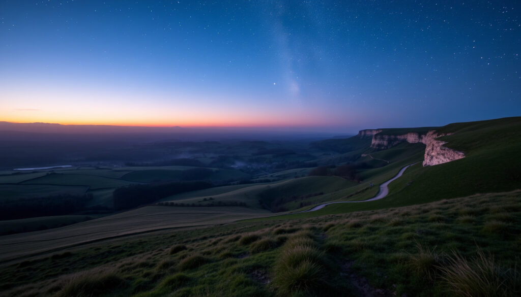
The South Downs was awarded International Dark Sky Reserve status in 2016, one of only 16 such reserves in the UK. Light pollution is strictly controlled, making the park one of the best places in southern England to see the Milky Way.
Best stargazing spots
- Devil’s Dyke – Devil’s Dyke Road, Poynings, Brighton. Easily reached by bus 77. A pub is nearby.
- Birling Gap – Near the Seven Sisters cliffs. Coastal access and part of the South Downs Way.
- Butser Hill – Queen Elizabeth Country Park, Hampshire. Dark Sky Discovery Site. Park at the car park off the A3 near Petersfield (GU32).
- The Trundle and Saddlescombe – Additional recognised dark sky locations.
When to go and events
The clearest skies are typically between autumn and spring. The annual Dark Skies Festival (usually in February) features talks, guided walks, telescope sessions, and planetarium shows. Weather conditions heavily affect visibility, so it is wise to check the forecast before setting out.
Snuggly clothing, a torch with a red filter, and a hot drink are recommended for nighttime stargazing. Many events are weather-dependent, so confirm details on the official park events calendar.
How do I plan a visit to South Downs National Park?
Getting a map
The official South Downs interactive map covers the entire park, including trails, car parks, and visitor centres. For the South Downs Way, a dedicated mapping tool is available at southdownsway.org.
Directions and transport
The park is about 90 minutes by train from London. Direct services run from London Waterloo and Victoria to stations such as Winchester, Lewes, Amberley, Southease, and Liss. Buses connect stations to villages; a Discovery ticket offers unlimited daily travel. Sustainable travel is encouraged – visitors are advised to leave the car at home.
Towns and postcodes inside the park
There is no single postcode for the park. Key visitor gateways include Winchester (SO23), Petersfield (GU32), Devil’s Dyke (BN45), Arundel (BN18), Seven Sisters/Birling Gap (BN20), and Eastbourne (BN20-22). For precise directions, use the Royal Mail postcode finder for your specific destination.
Visitor centres
Main visitor centres are located in Petersfield (GU31 4PT) and Midhurst (GU29 9AW). They offer information, maps, and advice. The park also has information points at key car parks and trailheads.
Some walking routes may be altered by erosion or land management. Check local signs and the official website before setting out, especially along cliff paths at Birling Gap and Beachy Head.
What is the planning permission process in South Downs National Park?
Because the South Downs is a national park, planning permission is handled by the South Downs National Park Authority rather than the local district council. This means stricter controls on development to protect the landscape.
Homeowners, businesses, and landowners must apply for planning permission for most new buildings, extensions, and changes of use. The authority publishes a Local Plan that sets out policies for development. Applications can be searched and tracked online through the authority’s planning portal.
For specific questions about whether a project requires consent, it is advisable to contact the authority’s planning department directly. The process can be more complex than outside the park boundary.
Planning consent is required for many home improvements that might be permitted elsewhere. Always check with the South Downs National Park Authority before starting any building work.
When was the park designated and what are key milestones?
- – Proposal for a South Downs National Park approved by government.
- – Designation order confirmed following a public inquiry.
- – South Downs National Park officially designated.
- – South Downs National Park Authority established.
- – Awarded International Dark Sky Reserve status.
- – Ten-year anniversary; launch of new management plan.
What information is certain and what remains unclear about the park?
| Established information | Information that remains unclear or variable |
|---|---|
| Boundaries are legally defined by the designation order. | Access to specific viewpoints may be seasonally restricted (e.g. cliff paths). |
| The park is an International Dark Sky Reserve (certified). | Postcode coverage can be confusing – visitors should use postcodes of main visitor centres (e.g., Petersfield, Midhurst). |
| Planning applications are handled by the South Downs National Park Authority. | Some walking routes may be altered by erosion or land management. |
What makes South Downs National Park special?
As England’s newest national park, the South Downs contrasts with older parks like the Lake District. Its chalk downland ecosystem is globally rare, supporting wildflowers, butterflies, and bird species that depend on this habitat. The topography is gentler than northern parks, making it highly accessible for walkers, cyclists, and families.
The park also protects ancient woodlands, river valleys, and a coastline of white cliffs at Seven Sisters and Beachy Head. Its International Dark Sky Reserve status adds a unique dimension, drawing stargazers from across the region. With 2.2 million people living within 10 km of the park, it is a vital green space for the South East.
Growing trends include dark sky tourism and increased demand for planning consent due to housing pressure. The park’s management plan, updated every few years, addresses these challenges while promoting recreation and biodiversity through initiatives such as ReNature.
What do official sources say about the park?
“The South Downs is known as the ‘gateway to England’ – its rolling green hills, globally important chalk grassland, ancient woodland, dark night skies…”
National Parks UK (nationalparks.uk)
“The South Downs National Park is England’s newest national park, designated on 31 March 2010.”
Wikipedia
These sources, alongside the official South Downs National Park Authority website, provide authoritative information on the park’s designation, size, and special qualities. Additional visitor-focused guidance is available from National Parks UK, Visit Eastbourne, and Visit Brighton.
What’s next for the park?
The South Downs National Park Authority continues to develop its Local Plan, which will shape planning policies for years to come. New dark sky events and star parties are regularly announced on the authority’s events calendar. For the latest updates, check the official website and explore proposed changes to the park’s management strategies.
Frequently asked questions
What is the postcode for the South Downs National Park?
The park covers a large area; there is no single postcode. Key visitor centre postcodes include Petersfield (GU31 4PT) and Midhurst (GU29 9AW). Use specific destination postcodes for directions.
How do I get directions to the South Downs National Park?
Directions depend on your entry point. Use the official map or search for a specific town or visitor centre within the park (e.g., ‘South Downs Visitor Centre postcode’). Most areas are accessible via A3, A27, and A272 roads.
Are there jobs available at the South Downs National Park Authority?
Yes, the authority periodically hires staff for roles such as rangers, planning officers, ecologists, and administrative positions. Check the official website’s ‘Jobs’ section.
Can I cycle in the South Downs National Park?
Yes, many bridleways, byways, and the South Downs Way are open to cyclists. Some trails are designated for mountain biking. Check the official website for maps and routes.
Are dogs allowed on walks in the park?
Dogs are welcome on most trails but must be kept under control, especially near livestock and ground-nesting birds. Some nature reserves may have seasonal restrictions.
Is the South Downs Way suitable for beginners?
The full 160 km trail involves rolling hills and can be challenging. However, shorter sections, such as between Devil’s Dyke and Brighton, are easier and popular for day walks.
Do I need a permit for wild camping?
Wild camping is not generally permitted in the South Downs National Park without landowner permission. There are many campsites and bothies available. Check with the authority for guidance.
Can I visit vineyards in the park?
Yes, several vineyards welcome visitors for tours and tastings. Examples include those around the Arundel area. Check individual vineyard websites for opening times.
Are there visitor centres in the park?
Yes, main visitor centres are in Petersfield and Midhurst. There are also information points at key trailheads and car parks.
What is the best time of year to visit?
Spring and summer offer the best weather for walking and cycling. Autumn and winter provide clearer skies for stargazing. The park is beautiful year-round.
More related posts
 Karen Mulder – 2026 Comeback, Vogue Cover and Allegations
 Charlie Hunnam – Biography, Movies, Net Worth and Height
 DNA Tests – UK Guide for Ancestry, Paternity and Health
 Sid Sloths – Species, Gender, Family & Real Animal Facts
 Rag Doll – Toy, Cat Breed, Song And Film Guide
 Patrick Murray – Only Fools and Horses Actor Dies Aged 68
 Alfred Enoch – From Harry Potter to How to Get Away with Murder
 Robin Van Persie – Sacked by Feyenoord After One Season
