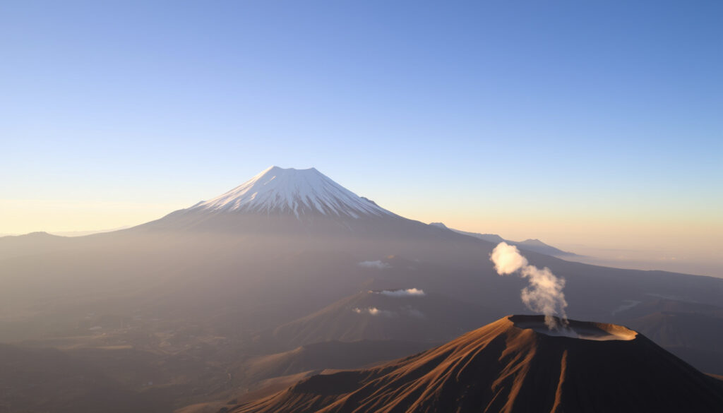
Mt Fuji – Climbing Routes, Eruption History & Viewing Tips
Mount Fuji is a defining geographic and cultural landmark for Japan, but planning a trip there—whether to climb or simply to view it from Tokyo—requires a clear understanding of its logistics, rules, and risks. The mountain is best understood as a seasonal, rule-bound, high-altitude climb that typically takes two days for those seeking a safe sunrise summit. Modern travel planning for Mount Fuji must account for mandatory fees, advance reservations, trail-specific opening dates, and the weather-dependent nature of visibility.
Standing as Japan’s tallest peak, Mount Fuji is an active stratovolcano with a well-documented eruption history. Its symmetrical cone is the result of volcanic activity that began approximately 100,000 years ago, according to Japan’s official tourism body. The mountain is located on the border of Yamanashi and Shizuoka prefectures, roughly 100 kilometers southwest of Tokyo, and was inscribed as a UNESCO World Heritage Site in 2013.
Climbing Mount Fuji is only officially permitted during a narrow summer window. In 2026, multiple sources indicate the official climbing season runs from July 1 to September 10. The Yoshida and Subashiri trails typically open earlier than the Fujinomiya and Gotemba trails. Over 300,000 people climb the mountain annually, with the vast majority doing so during this brief period.
How Tall is Mount Fuji and Where Is It Located?
3,776 m (12,389 ft) – Japan’s tallest peak
1707–1708 (Hoei eruption) – Active but dormant
Border of Yamanashi and Shizuoka prefectures, 100 km southwest of Tokyo
Official season July 1 to September 10 (weather permitting)
- Mount Fuji is an active stratovolcano with a well-documented eruption history; the last eruption was in 1707.
- Climbing is only officially permitted during summer (July–September) due to extreme weather and snow.
- Visibility from Tokyo is highly seasonal; clear winter days offer the best chance, while summer is often hazy.
- The mountain is a UNESCO World Heritage Site (2013) and a sacred symbol of Japan.
- Over 300,000 people climb Mount Fuji annually, with the Yoshida Trail being the most popular route.
| Attribute | Detail |
|---|---|
| Elevation | 3,776 m (12,389 ft) |
| Location | Yamanashi & Shizuoka Prefectures, Honshu, Japan |
| Type | Active stratovolcano |
| Last Eruption | 1707–1708 (Hoei eruption) |
| First Ascent | 663 AD (by En no Odzunu, legend) |
| Official Climbing Season | July 1 – September 10 |
| Number of Trails | 4 main trails (Yoshida, Subashiri, Gotemba, Fujinomiya) |
| Annual Climbers | ~300,000 (pre-pandemic) |
| UNESCO Status | World Heritage Site (2013) |
| Distance from Tokyo | ~100 km (62 mi) as the crow flies |
Is Mount Fuji an Active Volcano? Understanding Its Eruption History
Yes, Mount Fuji is an active stratovolcano. It forms part of the Pacific Ring of Fire, and its iconic symmetrical cone is a direct result of repeated eruptions over hundreds of thousands of years. The Japan Meteorological Agency continues to monitor the mountain for volcanic activity. According to the Japan National Tourism Organization, climbers should prepare for a sudden eruption by carrying a helmet and wearing it in case of hazards such as falling rocks.
When Was the Last Time Mount Fuji Erupted?
The last confirmed eruption occurred between 1707 and 1708, an event known as the Hoei eruption. During that event, ash fell on Tokyo, and the eruption is believed to have created the Aokigahara Forest, also known as the Sea of Trees. Before that, major eruptions were recorded in 864 AD and 800 AD. The exact date of the next eruption is unknown, and monitoring is ongoing.
Is Mount Fuji Dangerous?
Climbing Mount Fuji carries real risks. Beyond the volcanic hazard, the mountain is a high-altitude environment where altitude sickness, hypothermia, and falls are common. The official climbing website emphasizes route rules, clothing, and important safety points. With proper preparation, gear, and respect for weather warnings, the climb is considered safe for most hikers. Emergency contacts commonly listed for visitors are 110 for police and 119 for fire and ambulance in Japan, plus the Japan Visitor Hotline for multilingual support.
Since Mount Fuji is an active volcano, eruption-related planning should be treated as a real safety issue, not a theoretical one. The official climbing site is the best place to check for current warnings and advisories before departure. The JNTO’s climbing advice recommends carrying a helmet for protection against falling rocks and slipping.
How to Climb Mount Fuji: Routes, Duration, and Best Time
Climbing Mount Fuji requires careful planning. The best overall plan involves staying overnight at a mountain hut, then continuing to the summit for sunrise, known as goraikō. A one-day push is riskier and much harder on the body at altitude. The common itinerary involves arriving at a 5th Station in the afternoon, climbing to a hut around the 7th or 8th Station, sleeping for a few hours, then summiting before dawn.
What Are the Main Climbing Routes on Mount Fuji?
There are four main trails, each with distinct characteristics. The Yoshida Route is the most popular and is best for first-timers, with the best facilities and many huts. The Subashiri Route is less crowded and known for a sand descent. The Fujinomiya Route is the shortest but still steep and demanding. The Gotemba Route is the longest, least crowded, and more strenuous, best suited for experienced climbers.
| Trail | Best for | Typical Ascent | Key Notes |
|---|---|---|---|
| Yoshida | First-timers | About 5–7 hours | Most popular, best facilities, many huts, sunrise-friendly, but busiest. |
| Subashiri | Intermediate climbers | About 5–7 hours | Less crowded than Yoshida; known for a sand descent. |
| Fujinomiya | Time-pressed climbers | About 4–6 hours | Shortest route with the smallest elevation gain, but still steep and demanding. |
| Gotemba | Experienced/fit climbers | About 7–10 hours | Longest route, least crowded, more strenuous. |
How Long Does It Take to Climb Mount Fuji?
Total climbing time is commonly cited as 5 to 10 hours uphill, depending on route and pace. The descent usually takes about 3 to 4 hours. Many travelers should expect a 24-hour round trip if doing an overnight ascent with summit sunrise and descent the next day.
What Is the Best Time to Climb Mount Fuji?
The official climbing season is July 1 to September 10. Multiple guides say the best windows are weekday climbs in early to mid-July or late August to early September, when crowds are lower than peak holiday periods.
Staying overnight at a mountain hut helps with acclimatization and reduces the chance of altitude sickness compared with a fast same-day ascent. The practical way to make sunrise is to sleep at a mountain hut rather than climbing continuously through the night.
How to See Mount Fuji from Tokyo: Visibility and Travel Tips
Mount Fuji is approximately 100 kilometers from Tokyo as the crow flies. Whether you can see it from the capital depends almost entirely on weather and seasonal conditions. Winter months, particularly December to February, offer the clearest skies and the best chance of visibility. Summer is often hazy due to humidity.
Can You See Mount Fuji from Tokyo?
Yes, but it is not guaranteed. Mount Fuji is often shrouded by thick clouds during daylight, so visibility can be poor even during climbing season. Because visibility is weather-dependent, the mountain’s appearance from far away is not guaranteed, and sightseeing plans should include buffer days.
How Do I Get to Mount Fuji from Tokyo?
Travel to the mountain typically begins with a bus or train to one of the 5th Stations, depending on which trail you plan to use. The most common start point for the Yoshida Route is the Fuji Subaru Line 5th Station. Some routes begin from trail-specific 5th Stations, so your transport choice depends on which trail you use. Mountain access roads may restrict private cars during the season, making shuttle buses important. For those interested in broader travel planning, the Vw Crafter – Prices, Specs & Campervan Conversion Guide offers insights relevant to campervan travel in the region.
How to Check Mt Fuji Visibility?
Visibility forecasts are only reliable short-term. The Fujisan Visibility Index and similar tools can help with planning, but conditions change rapidly. The general rule is that clear winter days offer the best view, while summer humidity often obscures the mountain.
A mandatory ¥4,000 hiking fee is cited for all four trails in current 2026 guides and official travel writeups. On the Yoshida Route, there is an entry-time restriction: climbers not staying in a hut cannot enter between 2:00 p.m. and 3:00 a.m. the next day. The Yoshida Route also has a daily cap of 4,000 climbers, which is one reason to reserve early.
What Are the 2026 Climbing Rules and Access Planning?
A sensible booking sequence cited by multiple guides is to book the mountain hut first, as huts sell out quickly in peak season. Next, reserve or pay the trail access or climbing fee. Finally, book transport to the 5th Station, because private-car access can be restricted and shuttle logistics matter in the season.
The official Mt. Fuji climbing website emphasizes route rules, clothing, and important safety points. As of the latest updates, the site reports there are no warnings or advisories posted. For those exploring other natural wonders, the Emperor Penguin – Complete Guide to Antarctica’s Largest Bird provides a comprehensive look at another extraordinary natural phenomenon.
Essential Gear for a Safe Climb
Commonly recommended items include hiking shoes with good grip, a hat and gloves for cold and sun protection, rainwear and a jacket for rapidly changing mountain weather, quick-drying clothing and layers, a headlamp for night climbing, food and water with at least 2 liters of water recommended, trash bags, small cash, and a helmet for eruption-related protection per JNTO guidance.
A Timeline of Key Events in Mount Fuji’s History
- – Major eruption recorded in historical texts.
- – Eruption created the Aokigahara Forest (Sea of Trees).
- – Last confirmed eruption (Hoei eruption); ash fell on Tokyo.
- – First ascent by a woman (Lady Tatsu) under modern recording.
- – Construction of mountain huts and trails begins.
- – Mount Fuji designated as a national park (Fuji-Hakone-Izu).
- – Inscribed as a UNESCO World Heritage Site (cultural).
- – New climbing regulations and reservation system introduced.
What Is Well-Established and What Remains Uncertain?
| Established Information | Information That Remains Unclear |
|---|---|
| Mount Fuji is 3,776 m tall. | The exact date of the next eruption is unknown; monitoring is ongoing. |
| It is an active volcano; the last eruption was in 1707. | Visibility from Tokyo varies daily based on weather; forecasts are only reliable short-term. |
| The official climbing season is July 1 to September 10. | Climbing conditions (trail closures, weather) can change rapidly; always check official updates. |
| It is located between Yamanashi and Shizuoka prefectures. |
What Is the Deeper Significance of Mount Fuji?
Mount Fuji is a sacred symbol in Shinto and Buddhism, inspiring art, literature, and pilgrimage for centuries. It attracts millions of visitors annually, and the climbing season is congested, leading to environmental concerns that have prompted new regulations. The mountain forms part of the Pacific Ring of Fire, and its symmetrical cone is a result of repeated eruptions. Safety considerations include altitude sickness, hypothermia, rockfall, and overcrowding, making preparation essential.
What Are the Sources and Key Quotes About Mount Fuji?
“Mount Fuji is an isolated peak exceeding 3,000 meters in elevation. While it boasts a breathtakingly beautiful appearance, it also possesses a…”Official Mt. Fuji Climbing Website (fujisan-climb.jp)
“Standing at 3,776 meters, Mt. Fuji is the tallest peak in Japan, the result of volcanic activity that began approximately 100,000 years ago.”Japan Travel (japan.travel)
“It is the highest mountain in Japan, the second-highest volcano on any Asian island…”Wikipedia (en.wikipedia.org)
What Comes Next: Future Developments and Planning
Continued monitoring for volcanic activity by the Japan Meteorological Agency remains ongoing. Potential implementation of a reservation system for climbers to manage crowds is already in pilot, and there is an increased focus on sustainable tourism and reducing environmental impact. Travelers are advised to check the official climbing website for current trail conditions, use visibility forecast tools to plan Tokyo viewing, and book climbing permits and accommodation well in advance during peak season.
Frequently Asked Questions
What is the Mt Fuji city?
There is no city named ‘Mt Fuji’. Nearby cities include Fujiyoshida (Yamanashi) and Fuji (Shizuoka). The town of Fujinomiya is also a popular base for climbers.
What is the Mt Fuji map?
A map of Mount Fuji typically shows the four main climbing trails, mountain huts, stations, and surrounding towns. The official climbing website provides a downloadable PDF map.
How many people climb Mount Fuji each year?
Approximately 300,000 people climb Mount Fuji annually, with the majority during the official July-September season.
Is Mount Fuji dangerous?
Climbing Mount Fuji carries risks such as altitude sickness, hypothermia, and falls. With proper preparation, gear, and respect for weather warnings, it is considered safe for most hikers.
What is the best season to see Mt Fuji from Tokyo?
Winter (December to February) offers the clearest skies and the best chance of visibility. Summer is often hazy due to humidity.
Are there any Mt Fuji restaurants near the summit?
Mountain huts on the trails offer basic food and drinks. At the 5th Station, there are several restaurants and snack shops. Famed ‘Mt Fuji Restaurant’ is likely a specific establishment in Tokyo or near the mountain.
More related posts
 Hula Hoop – Complete Buying Guide and Health Benefits
 Robin Van Persie – Sacked by Feyenoord After One Season
 Pete Burns – Cause of Death and Full Biography
 Pimlico Plumbers – Owner, Reviews, Landmark Case and Net Worth
 Karen Carpenter – Her Tragic Death and Lasting Legacy
 Martin Luther King – Biography, Speeches, and Legacy
 Fara Williams – Career, Personal Life, and Arsenal Legacy
 Ella Fitzgerald – The First Lady of Song in Full
